
Fiileq:Extensión del ruso2.png
Ingen højere opløsning fundet.
Extensión_del_ruso2.png (380 × 315 billedpunkter, filstørrelse: 89 KB, MIME-type: image/png)
| Beskrivelse |
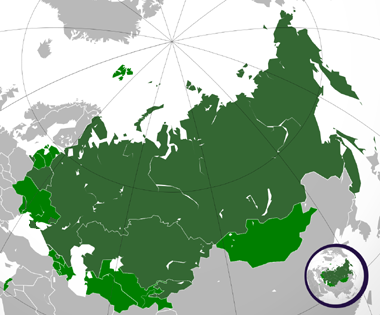
Español: Extensión del ruso. |
| Dato | (UTC) |
| Kilde | |
| Forfatter |
|
.svg)
Jeg, dette værks ophavsretsindehaver, udgiver hermed værket under den følgende licens:
Denne fil er licenseret under Creative Commons Navngivelse 3.0 Unported-licensen.
- Du må frit:
- at dele – at kopiere, distribuere og overføre værket
- at remixe – at tilpasse værket
- Under følgende vilkår:
- kreditering – Du skal give passende kreditering, angive et link til licensen, og oplyse om der er foretaget ændringer. Du må gøre det på enhver fornuftig måde, men ikke på en måde der antyder at licensgiveren godkender dig eller din anvendelse.
The map has been created with the Generic Mapping Tools: https://www.generic-mapping-tools.org/ using one or more of these public-domain datasets for the relief:
|

|
Tilladelse er givet til at kopiere, distribuere og/eller ændre dette dokument under betingelserne i GNU Free Documentation License', Version 1.2 eller enhver senere version udgivet af Free Software Foundation; uden et invariant afsnit, ingen forsidetekster, og ingen bagsidetekst. En kopi af licensen er inkluderet i afsnittet GNU Free Documentation License. |
Du kan vælge den licens du foretrækker.
Oprindelig oplægningslog
This image is a derivative work of the following images:
- File:Russian_Federation_(orthographic_projection).svg licensed with Cc-by-3.0, GFDL-GMT
- 2008-11-24T03:09:11Z Shibo77 541x541 (586989 Bytes) {{Information |Description=.. |Source=.. |Date=.. |Author=Ssolbergj |Permission=.. |other_versions=.. }}
- 2008-10-30T17:14:56Z Shibo77 541x541 (586026 Bytes) +Kurilojn k Grandan Diomedeon
- 2008-10-21T00:09:37Z Ssolbergj 541x541 (583897 Bytes) {{Information |Description= |Source= |Date= |Author= |Permission= |other_versions= }}
- 2008-10-21T00:01:03Z Ssolbergj 765x990 (426047 Bytes) {{Information |Description={{en|1=Russia}} |Source=Own work by uploader |Author=[[User:Ssolbergj|Ssolbergj]] |Date= |Permission= |other_versions= }} [[Category:Maps of Russia]]
Uploaded with derivativeFX
Filhistorik
Klik på en dato/tid for at se filen som den så ud på det tidspunkt.
| Ulloq/Piffissaq | Miniaturebillede | Dimensioner | Atuisoq | Kommentar | |
|---|---|---|---|---|---|
| nuværende | 20. Jul 2015, 02:00 | | 380 × 315 (89 KB) | Viet-hoian1 | Actualización de Donetsk y Lugansk |
| 8. Apr 2014, 20:33 |  | 380 × 315 (73 KB) | Iñaki Salazar | Reverted to version as of 12:32, 21 March 2014 | |
| 21. Mar 2014, 15:40 |  | 380 × 315 (91 KB) | Bobek | Reverted to version as of 22:59, 5 March 2011 | |
| 21. Mar 2014, 12:32 |  | 380 × 315 (73 KB) | Мечников | Крым | |
| 5. Mar 2011, 22:59 |  | 380 × 315 (91 KB) | Wadim | Mapa confuso; mezcla idioma oficial (nacional) con oficial (local) (especialmente en Ucrania); podría existir con explicación apropiada como imagen independiente de esta | |
| 7. Feb 2011, 05:11 |  | 380 × 315 (66 KB) | Fobos92 | Mapa en tres colores. | |
| 7. Jan 2010, 00:55 |  | 380 × 315 (91 KB) | Wadim | {{Information |Description={{en|Russia on the globe.}} {{ru|Россия на глобусе.}} {{tr|'''Rusya''''nın yerküre üzerindeki konumu.}} |Source=*File:Russian_Federation_(orthographic_projection).svg |Date=2010-01-07 00:44 (UTC) |Aut |
.svg)
Innersuutit
Der er ingen sider der bruger denne fil.
Global filanvendelse
Følgende andre wikier anvender denne fil:
- Anvendelser på alt.wikipedia.org
- Anvendelser på ru.wikipedia.org